 Colpo di pedale cycling tours


TOUR OF MILITARY FORTIFICATIONS
Total length: 150 km
Total gradients: 4.900 mt
Number stages: 4
Difficulty level: difficult
Average daily gradients: 1200 mt.
Average distance: 40 km
Daily hours on the bike: 5-7
Period: from the end of June to mid september
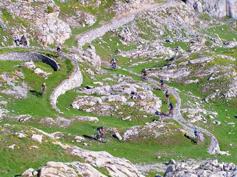
Four days biking along the roads and dirt paths of military fortifications on the border between
the Italian regions of Piemonte e Liguria and France.
A tour of about 5.000 meters in altitude and 150 km and 5.000 meters in total gradients, which crosses national borders to meet France in the Valley of Meraviglie and then later return to Italy
in the Ligurian hinterland.
The tour, suitable for trained cyclists, uses the network of dirt tracks and mule tracks connecting the numerous military fortifications that were erected from 1881 across the entire area of the
Maritime Alps and Ligurian wich bordered with France to build a strong line of defense in the context of the wider system of Vallo Alpino.
The departure is from the Natural Park of Pesio and Tanaro Valley between a luxuriant and wild vegetation, the itinerary winds its way completely on a dirt patch, varied, sometimes
technical.
The effort made on the climbs will be compensated by magnificent descents on single track.
First stage:
km 44
Gradients: 1.850 mt
Point of departure: Chiusa Pesio (Italia)
Arrival location: Casterino (Francia)
This route follows a military road built in the years '30 within the buildings of the "vallo alpino". The old road, now trail is a suggestive route that from the heart of the natural park leads
to the border with France, crossing the magnificent karst plateau of the Conca delle Carsene with rock walls high hundreds of feet and with the hard climb that we approached the French-Italian
border.
From the Certosa di Pesio (859 mt), a former monastery was founded in 1173, go up to Pian delle Gorre (1.032 mt) and from here on the left for the route that leads to the Refuge Garelli and the
Saut, turn right onto Duke's Pass then get to Gias degli Arpi (1,435 mt - 7.5 km, fountain).
From here the route is more stony and more pending. From the colle of Prel (1.925 mt), panoramic location, follows the original route, now covered with grass and sliding, omitting the sections
that cut the path, not ridable.
Arrived to Passo del Duca (altitude of 1,989 m - 9 km from Pian delle Gorre) the itinerary continues with a technical trail 2.5 km towards Gias dell'Ortica (at the fountain the altitude is 1.855
metres above sea level), follow the marked trail north of the little house and going up to 3.5 km we arrive to Colla Piana di Malaberga, (Capanna Morgantini), altitude 2.219 metres above sea
level.
Having reached the science station "Capanna Morgantini" (altitude 2.219 metres above sea level), the bikers will go to the fortifications of Limone Piemonte and from here with a fun technique
descent, among pine forests, they reach in French territory, Casterino.


Second stage:
km 45
Gradients: 1.270 meters
Point of departure: Casterino (Francia)
Arrival location: Colla Melosa (Italia)
The second stage starts fromCasterino, the gates of the Parc National du Mercantour,
down to the small medieval village of La Brigue, long climb to the Col Linaire (1,440 mt) and Baisse de Sanson (1,707 m), from here you ride at high altitude on a former Military Road, a long
transverse pass near the military barracks named to the First Alpine Regiment and after about 2 km keeping to the right the climb takes us to the ruins of the six barracks of Marta.
We recommend to visit the Marta's balcony, a rocky ridge that stretches from the Cima di Marta with its fortifications towards the Roya Valley.
In the bowels of the Marta's balcony lies the battery 605, excavated between 1938 and 1940 is the largest fortified complex in the cave in Western Alps.
The itinerary continues from the ruins of the barracks reaching a maximum altitude of 1960 meters and from here begins the descent, passing near the Grai Refuge where opposite you can admire the
rocky of massive dimensions of Monte Pratavecchia, the descent becomes steeper toward the bottom of the valley in the direction of the basin, the environment becomes harsh and rocky until the
arrival of Colla Melosa (1.540 meters) where ends the second stage.
Third stage:
km 41
Gradients: 1.300 meters
Point of departure: Colla Melosa
Arrival location: Colle dei Signori
Departing climbs along the military road from stony ground along the slopes of Mount Grai until Passo di Collardente (1.617 meters) and then to the Tanarello pass (2.045 meters – km 23), from
here there will be a long stretch flat with a landscape that alternates open meadows to the woods of larch, in the Vallone di Tanarello we have a wonderful panorama on Monesi and the statue of
the Redentore.
On this itinerary one of the most beautiful point is the crossing of the ancient forest of larch and fir in the Wood of the “Navette” with beautiful panoramic views in an atmosphere of peace and
silence where nature shows off its colors in every season, from the green of the trees with multicolored hues of the flowers in the glades.
Continuing on the military road up to the pass of Flamalgal (2.179 mt) and from here you reach the Colle dei Signori (2.080 meters) point of arrival of the third day.
Fourth stage:
km 21 - Gradients: 460 mt
Point of departure: Colle dei Signori
Arrival location: Chiusa Pesio
From Colle dei Signori take a path that runs along one of the karst plateau of high altitude more impressive that we can contemplate in this area, just beyond Pian Ambrogi you will reach the
Colla di Malaberga (2.219 mt), near the speleological refuge Capanna Morgantini, from here the old military road from the early 1940s descends proceeding in the Conca delle Carsene until Gias
dell'Ortica (1.855 mt).

Going back to the Passo del Duca and from there down on the old military road that leads to the wide curves of Gias degli Arpi (1,460 m), in the shadow of the majestic fir trees of the forest of Prel we arrive to locality Saut, from here the path takes us back to Pian delle Gorre (1.000 mt) and Certosa di Pesio (859 mt) before arriving at Chiusa Pesio, small town where the Tour of military fortifications ends.
For the duration of the tour will be accompanied by qualified guides, mechanical assistance and
logistical support is provided by the guides themselves, supported by off-road vehicle that followed the bikers throughout the tour (with the exception of some sections where descents or ascents
on the path not allow the passage of the vehicle).
The vehicle will transport your luggage from one refuge to another. It is admitted only one small luggage per person.
Other conditions are: sleep in shelters in dormitories where the toilets are shared with other guests. Dinner is served at the refuge and the menu is that offered by the refuge, lunch is
packed.


Copyright © colpodipedale.it